

The water plan area
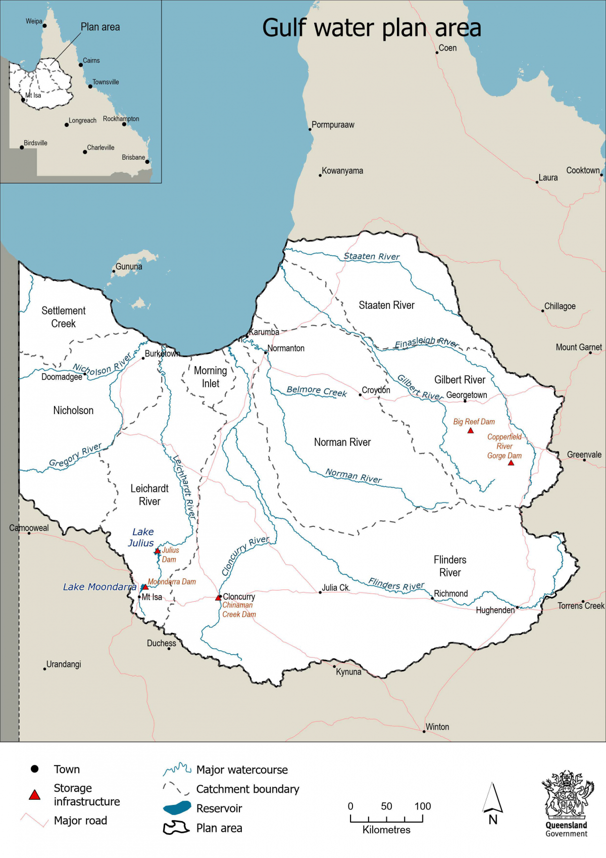
The Gulf water plan area covers 317,048 km2 in far North-West Queensland and includes the catchment areas of the Flinders River, Gilbert River, Leichhardt River, Morning Inlet, Nicholson River, Norman River, Staaten River and Settlement Creek.
The water plan borders the Georgina and Diamantina, Cooper Creek, Burdekin Basin and Mitchell water plan areas.
Map of the Gulf water plan area
 © Queensland Government
Explore the Gulf and its surrounding water plan areas via the Queensland Globe water plan map (use Google Chrome for best results).
Last updated: 19 Jul 2024