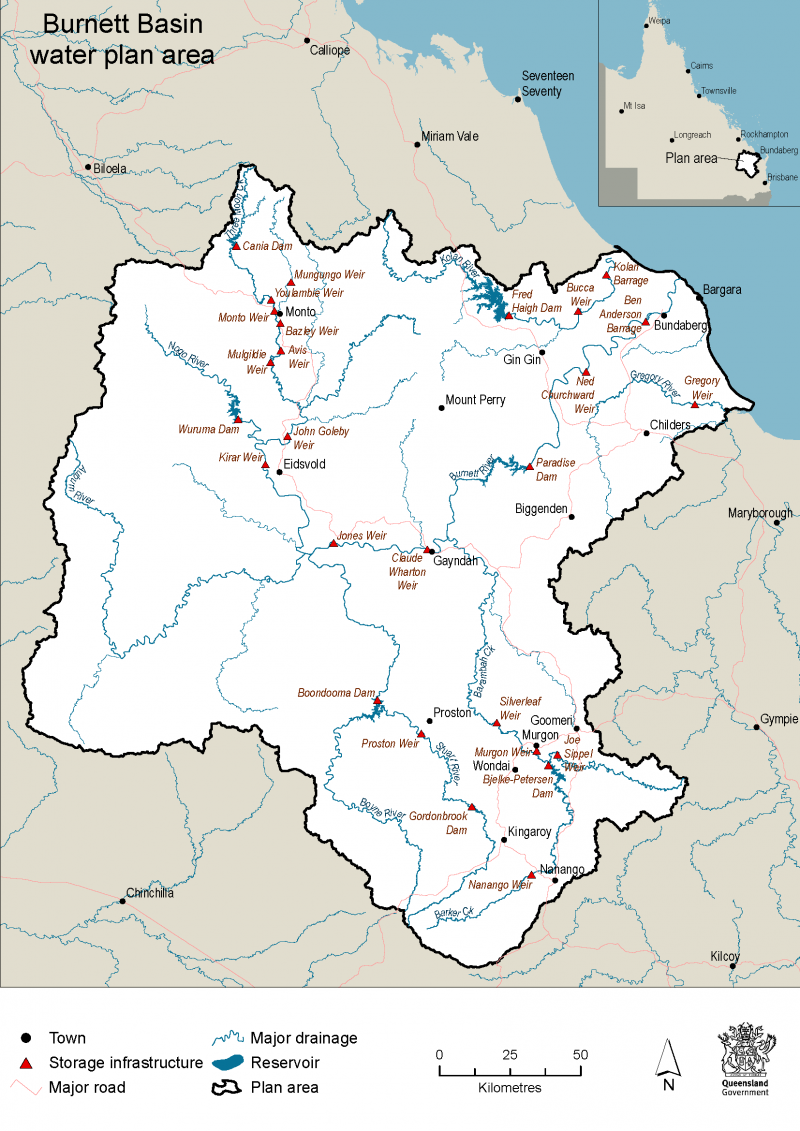
About the Burnett Basin water plan
The Burnett Basin water plan area covers approximately 38,370 square kilometres. It is a highly developed region and is home to many environmentally significant plants and animals including the Australian Lungfish.
Rivers and creeks in the area are seasonal which means water volume and flow naturally change throughout the year. Major waterways include the Burnett River, Barker Creek, Barambah Creek, Boyne River, Stuart River, Auburn River, Three Moon Creek, Kolan River, Elliott River, Gregory River and Isis River.
Water in the plan area supports towns, industry, tourism and agriculture (including sugar cane and macadamia production) and grazing. It also supports habitat for five species of freshwater turtle, platypus and many fish species.
The Burnett Basin contains a number of protected areas of conservation and ecological significance, including Coalstoun Lakes, which is listed in the national Directory of Important Wetlands.
Use the Queensland Globe water plan map (use Google Chrome for best results) to explore the Burnett Basin and its surrounding water plan areas.
How we manage water
As part of the review, we have a chance to reconsider how we manage water in the area.
The Burnett Basin water plan sets the rules for allocation and use of:
- surface water in watercourses (rivers, streams, creeks etc), lakes and springs
- overland flow water
- groundwater.
Last updated: 18 Apr 2024

