

Rainfall gauge satellite trial
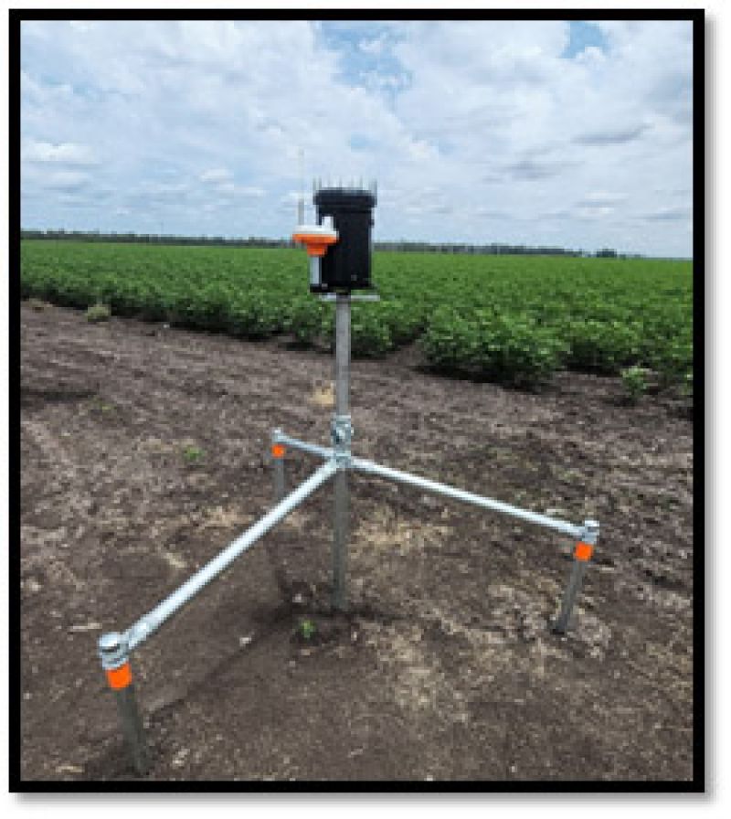
The Rainfall Gauge Satellite Trial (under the Enhanced Measurement Project) will enhance rainfall data intelligence and understanding of rainfall patterns and water availability for future water resource management. Emerging satellite technology is enabling the trial of low-cost automation of collecting and reporting rainfall data in remote locations.
This trial has been extended until March 2024 to gather further information during the summer season.
 © Queensland Government
This trial uses technology to collect rainfall data automatically in remote locations. Rainfall observations are increased by:
- gathering data from landholders who host a unit
- accessing low-orbiting satellites to transmit data where cellular coverage is limited
- designing a self-contained unit with lower power requirements.
Trial benefits
Automated rainfall data collected in this trial will enhance:
- coverage of rainfall observations in the Northern Murray-Darling Basin
- rainfall networks in the Northern Murray-Darling Basin
- early indications of potential river flows
- accuracy of water budget calculations.
The Department of Regional Development, Manufacturing and Water (DRDMW) will collaborate with other partners to research the emerging technology and share rainfall data collected.
About the trial
Queensland landholders in the Northern Murray-Darling Basin region are participating in this trial. A prototype rainfall gauge using emerging automated data collection technology has been installed in 49 locations.
- Start date: December 2022.
- Trial duration: 15 Months.
- Data accessibility: Desktop computer, laptop or mobile device that has an internet connection to access RDMW's Water Monitoring Information Portal (WMIP).
- Feedback: Trial participants will be asked to provide feedback throughout the trial.
View trial rainfall data
The rainfall gauge data collected in this trial is transmitted securely through a low-orbiting satellite network. The antenna only activates when a satellite passes overhead. This is a power saving measure that keeps data collection costs lower.
The rainfall totals measured by the trial equipment at each remote site is usually published on the WMIP each morning at approximately 9am and can be viewed on any internet-enabled device.
For the latest information about stream and river heights for flood warning purposes, refer to the Australian Government Bureau of Meteorology website.
Support
For any issues accessing the rainfall gauge data in the WMIP, or assistance with the trial device, contact RDMW by sending an email to raingaugetrial@itp-qld.atlassian.net. In the subject line of the email please include the device owner station name and a brief issue summary. Include a detailed description of the issue or support being sought in the email body.
![]()
The Queensland Department of Regional Development, Manufacturing and Water (DRDMW) gratefully acknowledges the Australian Government’s financial contribution to the Rural Water Futures Program through the Murray-Darling Basin Authority and the Murray-Darling Basin Communities Investment Package, delivered under the Murray-Darling Basin Plan by the Queensland DRDMW, through funding from the Australian Government Department of Climate Change, Energy, the Environment and Water.
Last updated: 30 Oct 2023